
Effectiveness of Disaster Risk Reduction (DRR) programs funded by ECHO in the Caribbean
Evidence collected after hurricanes Irma and Maria
13 october 2017
Introduction
The 2017 hurricane season has been exceptionally destructive, causing large-scale disasters throughout many islands and countries.
Irma - a Category 5 hurricane - caused widespread devastation on many Caribbean islands with winds of
296 km/h bringing heavy rains and causing deadly waves. It was formed on 30th of August and dissipated on 16th of September. Irma is the longest lived storm of that intensity anywhere around the globe for at least the past 50 years.
A combination of strong winds, storm surges and intense rainfall resulted in loss of life, significant damage to homes and to critical infrastructure. The most severely affected countries include Cuba, Antigua and Barbuda, Turks and Caicos Islands, Saint Kitts and Nevis, Anguilla, British Virgin Islands, Saint Martin, Sint Maarten and Saint Barthélemy. At least 41 fatalities were reported in these islands. However, this relatively limited loss of life can in part be attributed to robust preparedness measures taken by national and local authorities before the hurricane made landfall.
Severe damage to housing, infrastructure, basic services such as health centres, telecommunication, electricity, water, sewage and waste systems, as well as agricultural land has been reported and is still critical. It is estimated that more than 5.8 million people have been affected in the Caribbean.
Less than two weeks after Irma, Category 5 Hurricane Maria, made landfall in Dominica on 19
September with maximum sustained winds of 260 km/h causing devastating impact on the island. This caused further humanitarian consequences in the region already severely affected by Hurricane Irma. After Dominica, Maria headed west-northwest towards Puerto Rico, devastating the island. Heavy rains, strong winds and storm surges also affected the rest of the Leeward Islands, the Dominican Republic, Haiti, the Turks and Caicos Islands and the Bahamas between 19 and 24 September. 65 000 people have been impacted in Dominica only. Hurricanes Irma and Maria combined have claimed more than 60 lives across the region.
ECHO in the Caribbean
Since 1994, the European Commission has provided o v er € 537 .6 m illio n in hum anitarian aid to the region through its Civil Protection and Humanitarian Aid department (ECHO). This funding has helped respond to disasters, and better prepare populations to future emergencies.
Slightly over 10% of this budget (€61 million) was dedicated to helping communities prepare and strengthen their resilience to disasters, through Disaster Risk Reduction (DRR) programmes in the Caribbean, often through ECHO's Disaster Preparedness – or DIPECHO- projects. During hurricanes Irma and Maria, it was shown that these programs facilitated the response in several affected countries, an important indicator of success.
Cuba
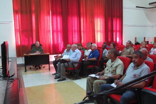
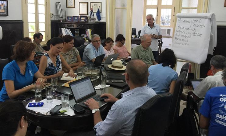
When category 5 Hurricane Irma hit Cuba on 8 September, the authorities (national civil defence, meteorological institute and hydrological institute) were monitoring the system permanently. Technology acquired through the DIPECHO FORSAT ("Fortalecimiento de Sistema de Alerta Temprana" or Early warning System Strengthening) project, implemented by ECHO partner the United Nations Development Program (UNDP) in Villa Clara and Sancti Spiritus, supported this task. Before Irma made landfall, a presentation was made by the authorities at the National Defence Council on the Integral Operational Management for decision makers, related to Early Warning Systems regarding extreme hydrometeorological events. Handbooks were distributed to all stakeholders as well as meteorological folders. The manual and the folder were produced in the framework of the FORSAT, funded by ECHO.
Activation of the National Defence Council and presentation of the EWS guidelines prior to the landfall (credits: National Civil Defence)
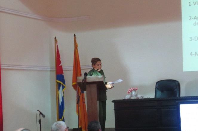
The authorities in charge acknowledged the usefulness of the Comprehensive Operational Management EWS handbook, produced through ECHO funding and taking into consideration past events. See below a presentation of the handbook on national television.

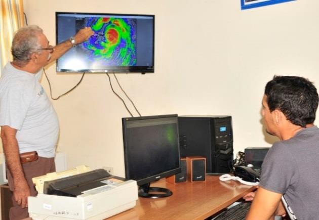
The meteorological institute gathered satellites imagery thanks to a station installed through the FORSAT project. This information was useful to generate more accurate forecasts and was then released to the general public. Thanks to the FORSAT project, numerical models could be elaborated and were
reliable for forecasting different parameters. This has been publicly recognized at national level during formal meetings.
The meteorological institutes of Villa Clara and Sancti Spiritus, where the project was implemented, transmitted information through wireless network to other actors of the early warning system. They were able to apply all that to improve emergency response. Imagery was also acquired thanks to stations installed in 2013 through a DIPECHO project after Hurricane Sandy and through the FORSAT project of 2015. The platform installed in the framework of the DIPECHO project allows real-time visualization of the Meteorological data. The direct monitoring of rain levels in watersheds was also continuously monitored thanks to the technology provided by the project.
In Villa Clara and Sancti Spíritus, the authorities activated all 5 Disaster Risk Reduction Centres and 15
Early Warning points. Thanks to this, permanent monitoring and constant transmission of information was organized from monitoring agents to authorities. Authorities used the resources and mechanisms put in place during the FORSAT project.
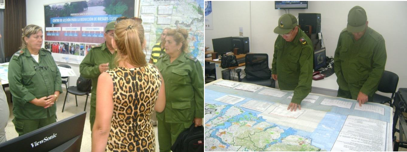
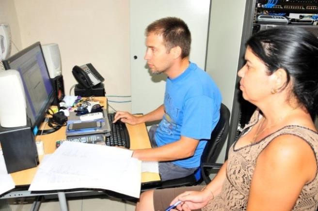
1 Activation of the Disaster Risk Reduction Centre in Sancti Spiritus Province (credit: Sancti Spiritus Government
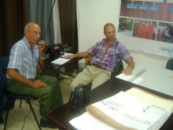
2 Communication and monitoring system during the event (Credits: government of Sancti Spiritus)
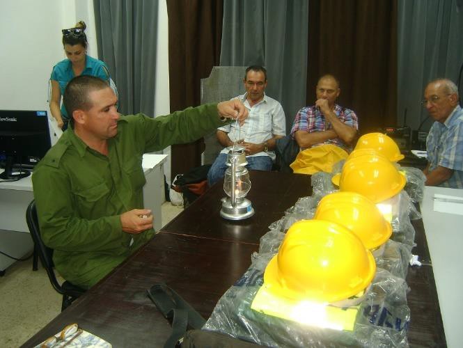
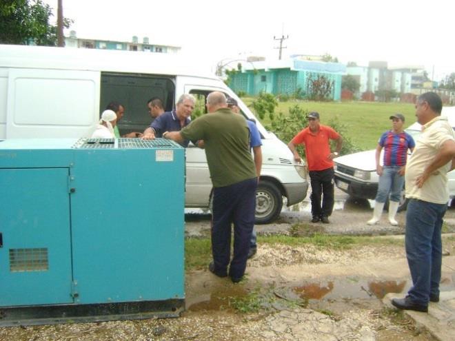
3 Material and equipment donated during the project were used in affected municipalities.
Authorities worked with the Disaster Reduction Plans updated in the framework of the FORSAT project - which enabled quicker decisions by the authorities depending on the hazards at hand (rains or winds).
4 An important role was also played by the national media during the hurricane response phase.
In another province, Camaguey, the Early Warning System was also strengthened through an ECHO- funded project implemented with the support of Save the Children, which installed equipment to monitor the phenomenon. This has been used successfully during the emergency and allowed a rapid flow of information for decision-making.
During the last two years, the DIPECHO project on Drought Preparedness - also implemented in the eastern region of Cuba by the World Food Program (WFP) and UNDP - has established a network of strategic alliances with key national and local actors for the management of the drought.
This network, which strengthens the relationship between institutions of hydro-meteorological surveillance of extreme events, civil defence, agriculture and local governments, has facilitated the availability of agile, comprehensible and integrated information (both meteorological and hydrological) for efficient decision-making before, during and after a hurricane.
In relation to the agencies, this network of alliances based on monitoring and response to hurricanes lays the foundation for building a similar network of relationships at local level in the central provinces, where the DIPECHO project does not operate, but where the drought has been severe in recent months.
Following the impact of Hurricane Irma, the project proves to be a tool capable of strengthening relationships to build resilience to multiple hazards (drought, hurricanes), and of strengthening response capabilities based on risk analysis from normal situations. These alliances, particularly in the area of
information management, also enabled the WFP to take a leadership role in the development of hurricane impact and response scenarios to feed the entire Action Plan system of the United Nations.
5 WFP share information with other agencies on scenarios
Saint Vincent & the Grenadines, Saint Lucia and Barbados
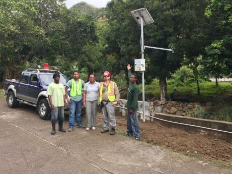
The rainfall data collected through rain gauges and water level monitoring stations installed through past DIPECHO projects across the region, provided near-real time data, to facilitate the understanding of the magnitude of the event, supporting National Emergency Operation Centres' decision making processes. This information also supported regional level planning, as it is fed into the description of rainfall impact on the other islands.
6 In Saint Lucia, authorities utilized the Common Alert Protocol warning app to issues updates and messages on the system.
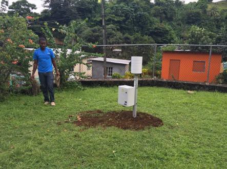
7 In Dominica, the recently installed equipment before Maria landfall supported decision making of the National Authorities.
Saint Kitts and Nevis
Reports shows that damages to houses in the locality of Conaree were insignificant thanks to mitigation projects carried during a past DIPECHO project more than 6 years ago, even though the place is located in the most impacted area of the country. The project had replaced galvanized roof sheeting using specific hurricane proof methodology. Trees planted more than 10 years ago through a DIPECHO project in St Peter's Ghaut also significantly limited erosion, the risk of landslides and flooding in the area.
Antigua and Barbuda
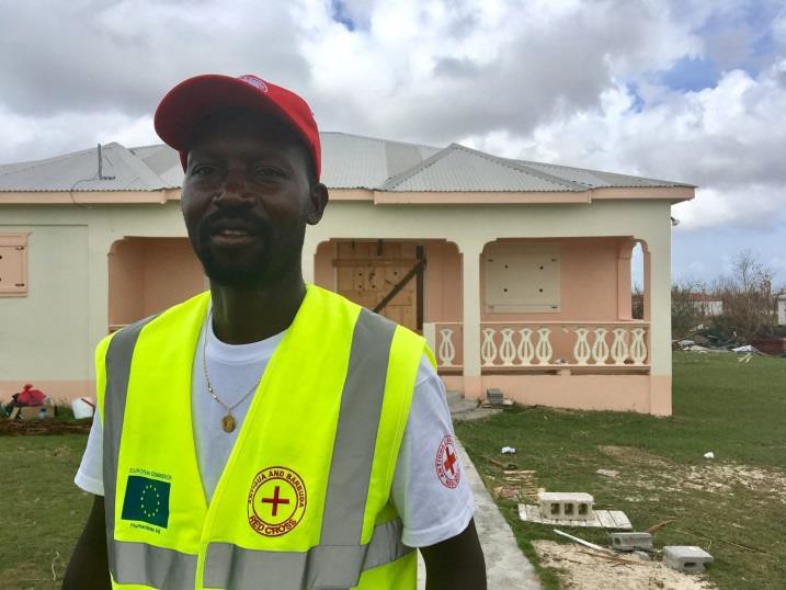
Due to past projects funded through the Red Cross in the region and specifically in Antigua and Barbuda in past years, local committees were strengthened and equipped, and this equipment could be seen during the response in Antigua and Barbuda, identifying the organized committees at local level. The Red Cross volunteers and staff were the first responders accompanying preparedness and response efforts in the country (rapid distributions were organized in coordination with local authorities).
Dominican Republic
Guidelines on Humanitarian Protection have been elaborated with support from OXFAM in the Dominican Republic through a previous DIPECHO intervention. The specific sectoral meeting group on shelter used it during the response. The participation of the Gender Unit and the Women Ministry allowed reflecting on gender issues and needs arising from the emergency. This Gender Unit was supported by a previous ECHO funding. During Hurricane Irma, people in San Cristobal were sheltered in mobile shelters implemented through a DIPECHO project in the past, managed by OXFAM. These mobile shelters are now completely under the management of local authorities. The local committees strengthened by OXFAM through previous DIPECHO projects acted quickly to prepare and respond to the emergency caused by Irma.
8 Mobile shelter
The coordinated articulations that have been set up with government agencies within the framework of the Drought Preparedness project in the Dominican Republic highlighted a set of measures that are crucial to prevention and response actions, both at community and agency level officers:
· A permanent WFP liaison was established in the Emergency Operation Centres (EOC) to advise and provide technical assistance in logistics matters.
· As a result of the strengthening of the Water, Sanitation and Hygiene (WASH) groups, their response protocols were activated, and the regional and provincial WASH groups operating through the Regional and Provincial Health Directorates were constantly updating the damage to water collection and distribution systems at the national level.
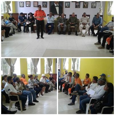
Strengthening of the Provincial and Municipal Prevention, Mitigation and Response Committees allowed for early action on Hurricanes Irma and Maria. Successful leadership and decision-making combined with synergistic work among institutions allowed the activation of the Early Warning Systems and Emergency Plans, avoiding the loss of life.
An example to be highlighted is the Dajabón provincial committee, as the Prevention and Mitigation Committee (CPMR)performed efficiently and effectively in the province for the activation of Early Warning Systems and emergency plans.
Haiti
Early warning / Rapid assessment / Temporary shelters management
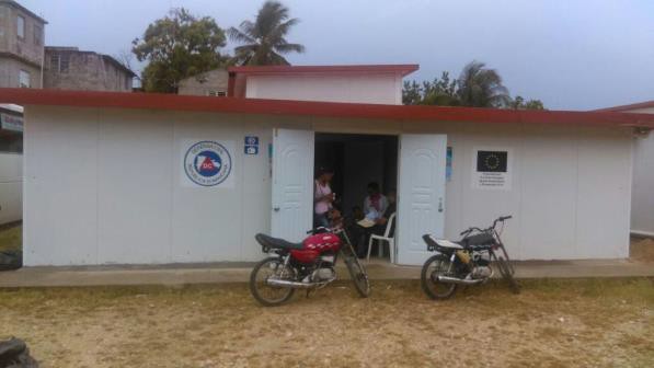
OXFAM collaborated with the Civil Protection Directorate in the northern part of the country (that most exposed to hurricanes Irma and Maria) to raise awareness and strengthen communication cells - Community Intervention Teams (EIC's, as per its initials in French). These structures were particularly active before, during and after both hurricanes, raising alerts and awareness, as well as response information to communities and local authorities. They also actively participated in initial rapid assessments and temporary shelters management.
Risk mapping / Simulation exercises / SOP's updates / Awareness
In the framework of the DIPECHO "Urban risk reduction" project, UNDP has produced a methodological guide on the reduction of natural risks in urban areas. Thanks to this methodology, several risk maps were produced also in the northern part of the country. They allowed, prior to Irma and Maria, the identification of areas prone to flooding and sea submersion. This allowed authorities and partners to define priorities for the early warning and evacuation of highly vulnerable and exposed populations. The same project also updated the operational procedures manual of the National Emergency Operations Center (COUN). A national simulation exercise in areas affected by hurricane Matthew (in the southern part of the country) was conducted as well. These activities contributed to strengthening the preparedness, response and coordination capacities of the emergency operations centres, at central and departmental levels. Capacities were later tested in real conditions, after Irma and Maria. These initiatives strongly contributed to improving the overall crisis management skills of the National Disaster Risk Management System.
Multi-Hazard approach / Water storage capacities / Awareness / Coordination
The ongoing drought preparedness initiative supported by ECHO in the lower North West and Upper Artibonite areas was adapted in order to contribute to preparedness and response efforts for Irma and Maria. The creation of monitoring and early warning cells to increase water resources management at community level, anticipating drought episodes and triggering response protocols, has shown its efficacy in the case of emergencies caused by all type of hydro meteorological hazards. The project has also enabled the development and strengthening of relationships with - and between - the Civil Protection Directorate (DPC), the National Potable Water and Sanitation Directorate (DINEPA, as per its initials in French) decentralized structures and local authorities, which reinforced multi-sectoral coordination. Moreover, the water reservoirs installed by this initiative to increase potable water storage capacities at community level were filled and treated in advance, to allow local residents rapid access to clean water in the immediate aftermath of hurricane Irma.
.


